English Harbour · Galleon Beach
Walking the Lookout Trail and Middle Ground
Two walks above English Harbour: a short, steep climb to Shirley Heights, and a ridge route with views across both harbours and ruins along the way.
- Parish
- St Paul
- From St John's
- 40 minutes
- Reading
- 3 min
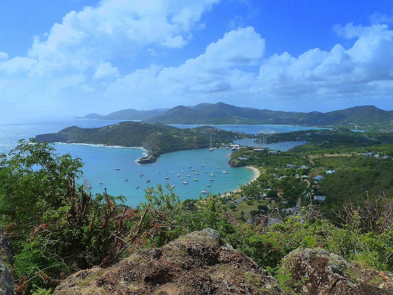
Around half an hour each way: that’s the walk from Galleon Beach up to Shirley Heights on the Lookout Trail. What does that half hour contain? A short, steep climb from the beach, with the trail gaining height above English Harbour. The route has a clear destination, with the slope and climb leading from the beach to the heights.
What’s the starting point? Galleon Beach, in English Harbour. The beach is also the starting point for walks to the Pillars of Hercules, so there’s more than one direction to take from here. One of those walks is the Lookout Trail, up to Shirley Heights. The other landmark is the carved cliffs at the harbour mouth. The names do a lot of the work: beach, trail, heights, harbour mouth. This is a landscape described by where the land rises and where the water lies.
How does the Lookout Trail feel underfoot? The facts give the useful outline rather than a detailed surface description: it’s short, steep, and climbs from Galleon Beach to Shirley Heights. That’s enough to set the shape of the walk. It isn’t a long, level stroll, and the half-hour figure doesn’t mean the climb has disappeared. It means the distance is compact; the slope is still the defining feature. A small route can ask for a steady bit of effort.
What’s growing on the slopes? Above English Harbour, the dry slopes are home to Turk’s cap cactus, century plants, and acacia. Those are the details to keep in mind as the trail rises: dry ground, plants adapted to that setting, and the harbor below. There’s little shade on trails around English Harbour, so the trails are cooler early in the morning. That matters on a steep walk, where the climb and the exposed slopes are part of the same picture.

And what about the Middle Ground? It’s a different walk, following the ridge between English Harbour and Falmouth Harbour. The trail starts near Pigeon Point beach, rather than at Galleon Beach, so it has its own starting point and its own line through the landscape. The ridge gives views of both English Harbour and Falmouth Harbour. The two harbors aren’t just names on either side of the route; they’re the main feature of the view from the ridge on this walk.
The ridge gives views of both English Harbour and Falmouth Harbour.
The ridge gives views of both English Harbour and Falmouth Harbour.
What lies along the Middle Ground ridge besides the views? Ruins of old military buildings. They’re part of the route’s character, set along a ridge that also connects the two harbor views. The walk brings together the dry slopes and plants above English Harbour with the remains of military buildings along Middle Ground. There’s no need to make the ruins stand for more than the facts give them: they’re there, along the ridge, in the same landscape as the trail.
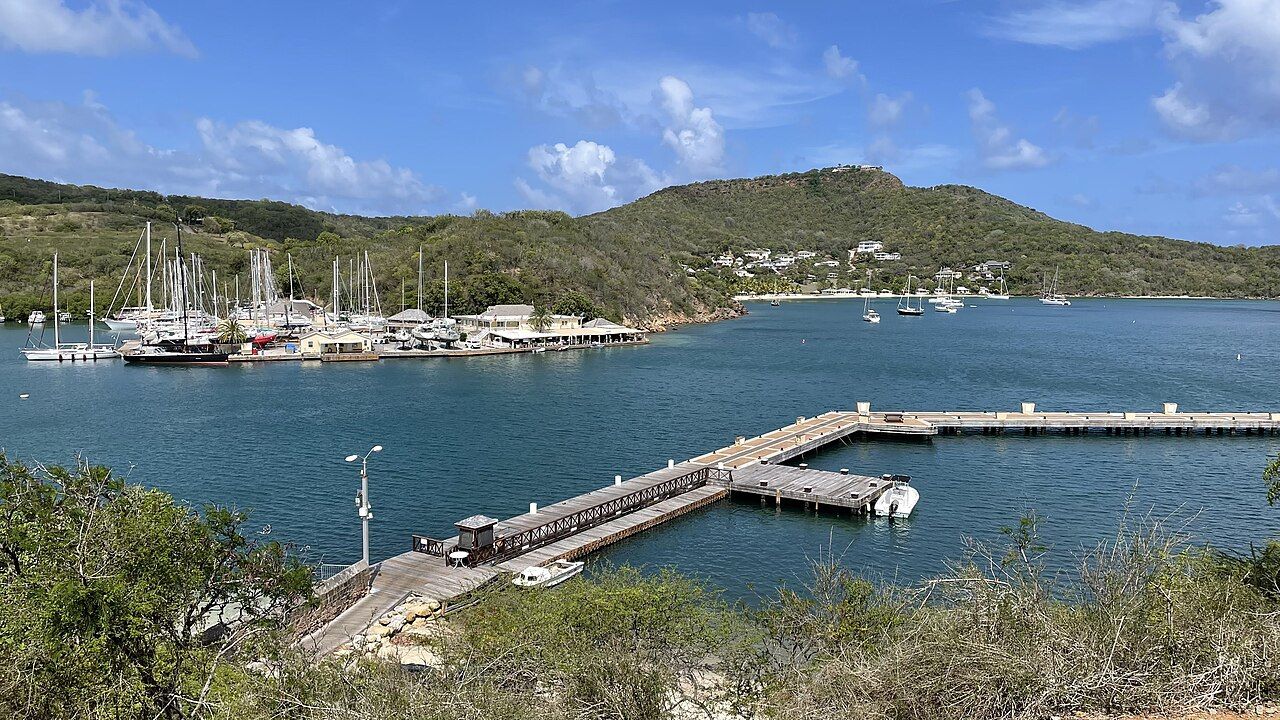
Is there more than one marked route in the area? Yes. The national park around English Harbour has a network of marked hiking trails. That broader network gives the two walks a wider setting, without making them the same walk: the Lookout Trail climbs from Galleon Beach to Shirley Heights, while Middle Ground follows its ridge between English Harbour and Falmouth Harbour. The terrain and destination change, but both routes belong to the walking landscape around English Harbour.
What might cross the trail? Hermit crabs often cross the trails around English Harbour. It’s a small detail beside the steep climb, the ridge, the harbor views, and the old military buildings, but it gives the walk another scale. The route isn’t only a line from one place to another. It’s also a way through the dry slopes, past the plants that grow there, with the chance of a hermit crab crossing the path.
Which walk fits the question being asked? For a short, steep climb from a beach to Shirley Heights, it’s the Lookout Trail. For a ridge route with views of both harbors and ruins along the way, it’s Middle Ground. They’re distinct walks with distinct starts: Galleon Beach for the Lookout Trail, near Pigeon Point beach for Middle Ground. And with little shade on the trails around English Harbour, the cooler early-morning hours belong in the picture too.
The numbers: around half an hour each way on the Lookout Trail. Which route would you take first?
Photo credits: giggel: Creative Commons BY 3.0; giggel: Creative Commons BY 3.0; Vincent van Zeijst: Creative Commons BY-SA 4.0.


