Antigua’s Six Parishes, and Where Barbuda Fits
A morning-to-late-afternoon orientation to Antigua’s six parishes, their named places, and the separate status of Barbuda and Redonda.
- Reading
- 2 min
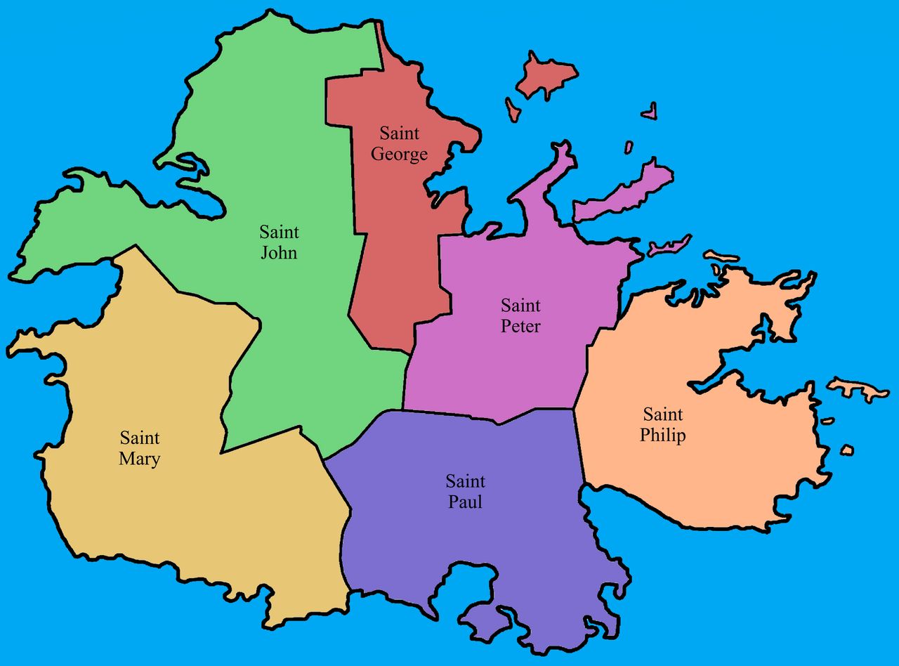
Morning: St John on the map
Where does a parish map of Antigua begin? With St John, which includes the capital, St John’s, and has the island’s largest population. The six parish names are St John, St George, St Peter, St Philip, St Paul and St Mary. That’s the basic frame: six divisions on Antigua, with the capital inside one of them. If the morning’s mental map starts in town, St John is the first name to place.
And from that starting point, where do the other named places sit?
When the sun stands overhead
Which parish lies north-east of the capital? St George, and it includes Fitches Creek. What about the south? St Paul covers the south of the island, including English Harbour and Falmouth. Those are two useful points on the map: St George is set by its direction from St John’s, while St Paul is described by its place in the south. For another northward reference, there’s the beaches north of the capital. The parish names don’t all come with a named landmark in this outline, but these show the map’s labels at work.
Late afternoon
And where’s the eastern edge? St Philip is Antigua’s easternmost parish, and includes Half Moon Bay and Freetown. St Peter and St Mary complete the six-parish list; they’re part of the same division of Antigua, even though no village or landmark is named here for either. That’s the parish map in words: a capital parish, a north-eastern parish, the south, the easternmost parish, and two more parish names to keep in the frame. It’s a simple distinction, but an important one: Barbuda and Redonda are dependencies of Antigua, not parishes.
So how does Barbuda fit? It has its own local government, the Barbuda Council, and sits outside Antigua’s six-parish arrangement. Redonda is also a dependency, and isn’t part of any parish. The two islands aren’t additional parish names, then; they belong in a separate part of the picture. Antigua covers about 280 square kilometers, and Barbuda about 160. The map has its divisions, and its exceptions. Which part would you want to place next?
The numbers: Antigua, about 280 square kilometers; Barbuda, about 160. What else belongs on the map?
Photo credits: Sulfire2: CC0 1.0 Universal.
